
The San Andreas Fault
 Scientists have learned that the Earth's crust is fractured into a series of 'plates' that have been moving very slowly over the Earth's surface for millions of years. Two of these moving plates meet in western California; the boundary between them is the San Andreas fault. The Pacific Plate (on the west) moves northwestward relative to the North American Plate (on the east), causing earthquakes along the fault. The San Andreas is the 'master' fault of an intricate fault network that cuts through rocks of the California coastal region. The entire San Andreas fault system is more than 800 miles long and extends to depths of at least 10 miles within the Earth. In detail, the fault is a complex zone of crushed and broken rock from a few hundred feet to a mile wide. Many smaller faults branch from and join the San Andreas fault zone. Almost any road cut in the zone shows a myriad of small fractures, fault gouge (pulverized rock), and a few solid pieces of rock.
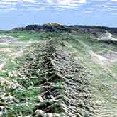
The San Andreas fault forms a continuous narrow break in the Earth's crust that extends from northern California southward to Cajon Pass near San Bernardino. Southeastward from Cajon Pass several branching faults, including the San Jacinto and Banning faults, share the movement of the crustal plates. In this stretch of the fault zone, the name 'San Andreas' generally is applied to the northeastern most branch. Over much of its length, a linear trough reveals the presence of the San Andreas fault; from the air, the linear arrangement of lakes, bays, and valleys in this trough is striking. Viewed from the ground, however, the features are more subtle. For example, many people driving near Crystal Springs Reservoir, near San Francisco, or along Tomales Bay, or through Cajon or Tejon Passes may not realize that they are within the San Andreas fault zone.
Blocks on opposite sides of the San Andreas fault move horizontally. If a person stood on one side of the fault and looked across it, the block on the opposite side would appear to have moved to the right. Geologists refer to this type fault displacement as right-lateral strike-slip. During the 1906 earthquake in the San Francisco region, roads, fences, and rows of trees and bushes that crossed the fault were offset several yards, and the road across the head of Tomales Bay was offset almost 21 feet, the maximum offset recorded. In each case, the ground west of the fault moved relatively northward.
Fact Credit
USGS General