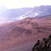
Haleakala Crater

Maui, one of the younger islands in this chain, began as two separate volcanoes on the ocean floor; time and again, eon after eon, they erupted and thin new sheets of lava spread upon the old, building and building until the volcano heads emerged from the sea. Lava, wind-blown ash, and alluvium eventually joined the two by an isthmus or valley, forming Maui, 'The Valley Isle'. Finally, Haleakala, the larger eastern volcano, reached its greatest height, 3,600 meters (12,000 feet) above the ocean - some 9,100 meters (30,000 feet) from its base on the ocean floor. For a time, volcanic activity ceased, and erosion dominated. The great mountain was high enough to trap the moisture-laden northeast tradewinds. Rain fell and streams began to cut channels down its slopes. Two such streams eroding their way headward created large amphitheater-like depressions near the summit. Ultimately these two valleys met, creating a long erosional 'crater'.
At the same time a series of ice age submergences and emergences of the shoreline occurred; the final submergence formed the four islands of Lanai, Molokai, Kahoolawe, and Maui. When volcanic activity resumed near the summit, lava poured down the stream valleys, nearly filling them. More recently, cinders, ash, volcanic bombs, and spatter were blown from the numerous young vents in the 'crater' forming multi-colored symmetrical cones as high as 180 meters (600 feet). Thus this water-carved basin became partially filled with lava and cinder cones, and it came to resemble a true volcanic crater. Several hundred years have passed since the last volcanic activity occurred within the crater. This stillness in Maui is attributed by modern geology to the constant northwestward movement of the pacific Plate.
About the Author
NPS National Parks Service
 The National Park Service is an agency of the federal government of the United States that manages all national parks, many national monuments, and other conservation and historical properties with various title designations.


